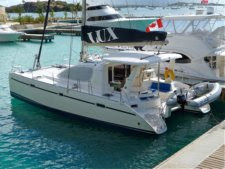
One of the reasons for selecting the Leopard 40 was that it was one of the largest catamarans that we could find that would fit under the ICW bridges. The specifications list the mast as 61ft 11in above DWL. LUX tends to sit bow-high in the water, so the actual mast height above the water with our typical load is a few inches more. As we use water, the height increases an inch or two.
We performed two measurements on LUX to determine the overall height, which includes the metal whip VHF antenna. Both measurements came in at 64ft 10in. The whip antenna is like the Shakespeare Classic 5242-A, which is 3 ft long. That correlates with the masthead at 62ft.
We read about the variations in bridge height on the ICW and decided that the best way to approach the trip was "carefully." When we approach a bridge, we make sure there is no other boat traffic (sometimes a challenge) and slow to a dead crawl (slow enough to react if the bridge is too low for us to pass, which we can tell by the wind instrument that's out front). We call it the "Bridge Dance." Having two engines to allow slewing the boat to adjust for wind and current is really nice. There is a big challenge when there is a strong current running with us and we have to use a significant amount of reverse power to counter the current.
Another idea that we've toyed with is running a GoPro up the mast on a boat hook, rigged as a gin pole on the Spinnaker halyard, to get it above the mast. With the wifi capability, we'd get to see the oncoming bridge on our iPad.
We have logged the bridge passages from Annapolis, MD to Ft. Pierce, FL. We are mostly successful in recording the following items:
* Bridge height board readings (when there are boards showing).
* The state of the tide and sometimes the height of the water on the bridge, based on past high water marks on the bridge fender boards.
* An estimate of how much we cleared or touched a bridge.
We keep the log in an Excel spreadsheet. It is provided below as a Google Sheets format so that you can download it and keep all the formatting. (There doesn't seem to be a way to upload a .xls file and make it available for download.) Any log entries where we have touched a bridge are noted in red. The log includes all bridges, even those that open, simply because they were in the original listing that we found online. The original listing shows the charted height of each bridge. We ignore that now and instead pay attention to the log entries we've made and the current state of the tide (or the wind if we're inshore where wind is the primary force that changes water height).
You are welcome to download and use it, but like any good mariner, you're responsible for your own actions in using anything in it. In other words, we're not responsible for your use of it. If you select all rows+columns, copy it, then paste into a spreadsheet, it will retain the formatting.
LUX Published ICW Bridge Log (updated 12/02/2019)
You can also use a GoPro camera on a pole to check the bridge clearance before attempting to transit a span that looks close. See our other post Verifying Bridge Heights.
You can also use a GoPro camera on a pole to check the bridge clearance before attempting to transit a span that looks close. See our other post Verifying Bridge Heights.
-Terry
No comments:
Post a Comment